
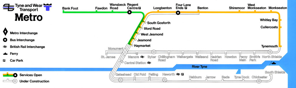
A beautiful early map for this system, clearly showing how much of it was planned from the start. Apart from a few name changes (the proposed “Old Fold” station became Gateshead Stadium, for example), this is recognisably the same map that existed as far into the future as the year 2000, when the proposed extension to Sunderland made its appearance.

The outlined route lines to show proposed/future extensions work wonderfully well, making an excellent contrast to the existing coloured routes. The approach is even carried through to outlining the names of the proposed stations – a lovely and deft design touch.
Another interesting feature is how small and low in the visual hierarchy the ferry across the River Tyne is: in later maps, the ferry symbol has become very large and overpowering.
Our rating: The original and the best. Simple, stylish, uncluttered design that sets out a clear vision for the future. Four stars.
Source: metromadme/Flickr