
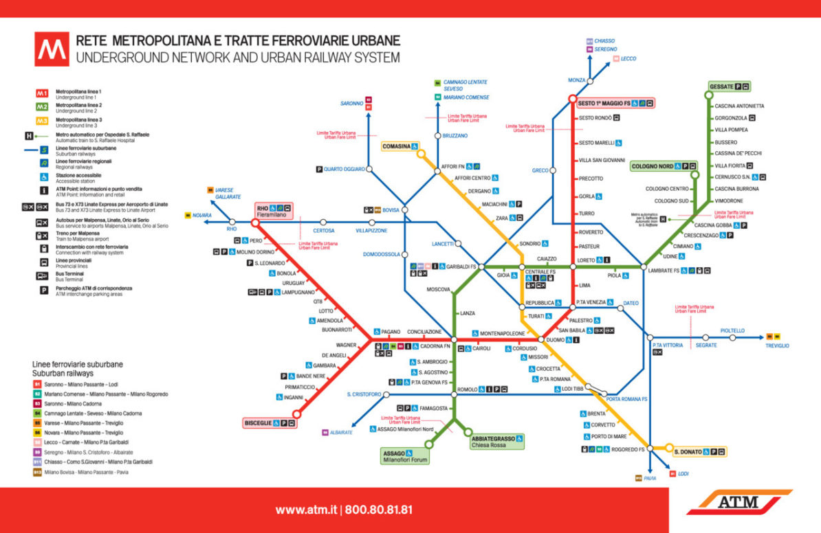
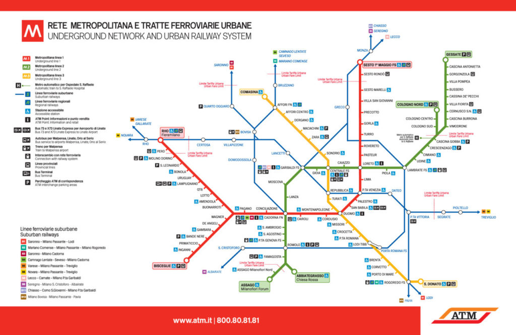
Milan’s Metropolitana subway system is Italy’s largest, and is supported by a comprehensive network of suburban and regional trains. It’s also linked by an amazing tram system, but no indication of those services, or connections to it, are presented on this map.
Have we been there? Yes, although I didn’t use the Metro, preferring to walk around Milan’s dense historic core.
What we like: Use of blue for the thinner suburban rail lines gives them their own distinct look while still being subordinate to the more important Metro lines. Comprehensive set of informational icons, although this does lead to some “icon overload” at Centrale and Cadorna stations. Important information is in Italian and English. Good accessibility information.
What we don’t like: A total absence of curved corners on routes gives a very severe, almost formal look to the map, as does the all-caps typeface used (which, despite being a bespoke typeface created for this map, ends up looking very similar to Franklin or News Gothic). The tinted colours behind the terminus station names, while effective at differentiating those stations from normal stations, looks a little old-fashioned.
Our rating: While this map looks quite sterile, it presents information quite clearly. I also feel that this look is totally intentional, as the streets of Milan’s historic medieval core are twisty and narrow. The contrast between those streets and the more direct routing of the modern subway is effectively highlighted in this map. Three-and-a-half stars.
Source: Official ATM website